Atworth - a Wiltshire Village
another village with lots of history
Let’s explore Atworth in Wiltshire
It’s a beautiful day, and walking around Atworth in the May sunshine is very pleasant. I decided to park my car at the top of the hill to take in the view as I walked into the village. It’s not a high hill, but it gives a nice perspective to start my exploration. The village is quite spread out, with the oldest collection of properties around the church on the west side of Atworth. I am starting my tour on the eastern edge, coming in from the direction of Melksham.
The Wiltshire village of Atworth is dissected by the A365, which runs from Seend, around seven miles southeast, through to Box, three miles to the northwest. It can be a busy road, and traffic today seemed to be in batches. I am carrying my DJI Osmo 2 Pocket camera and making a video as I walk for my YouTube channel. It’s a small camera with a built-in gimble making it ideal to be discreet when filming.
The origin of the village’s name is obscure. It has been referred to as Atford, Ateforde, Attewarde and Ateworthe, meaning 'Aetta's farmstead'. The name might come from Old English and have a connection to the word oats. The spelling of the name Atworth was established in 1858. No one is sure why ‘ford’ was attached to the name as there is no water that requires a ford to cross. There is only a tiny brook flowing outside the village, maybe that gave rise to the ford part of the name, but it would be a step over in most cases, and I am sure a bridge would have easily been built like the one in Purlpit. Water has always been readily available in the village. At one time, there were 76 wells and six public water pumps in the parish. I am looking out for one of the remaining pumps, which is located inside a bus shelter.
Atworth has many interesting buildings
When I visit a village, and Atworth, is one that I have driven through many times, I like to look for buildings that have changed use over the years. Buildings such as former chapels, pubs and shops. Each of these gives an indication of what life used to be like many years ago. My walk is to take me the length of the main road through the village; I will go past the various newer housing developments that run off it and then I will turn into Bradford Road, which is the original village centre and now is sat at one end surrounded by open countryside.
Ebenezer Chapel
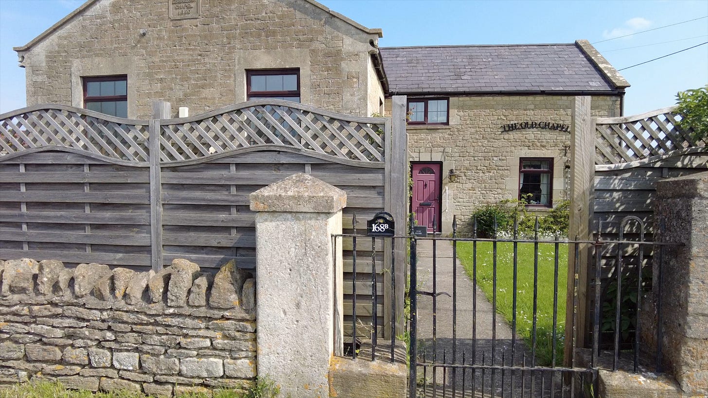
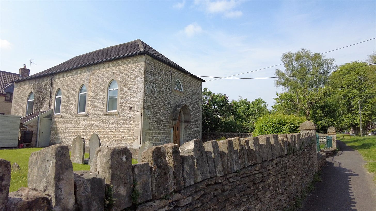
The first building I come to with a change of use lies on the corner of Purlpit, a lane that leads to a hamlet of the same name. Now a house, this was the Baptist’s Ebenezer Chapel, dated 1860. The chapel closed in 1979 and was converted to a house around 1990. I do remember it when it was in use, as I lived not far away in Melksham during the 70s. The Baptist influence was strong in the area from as early as 1660. Atworth was one of the parishes caught for holding an illegal meeting in 1669. The congregation in 1692 applied for a certificate to meet in a house and it’s also recorded in 1790 that they were still applying to meet in a house.
The building consisted of a main chapel with a schoolroom attached. Beneath the floor of the chapel was a large tank which was filled with water from the cottage next door when required for baptisms. There was seating for 120 persons, yet it only had six members the year after it opened.
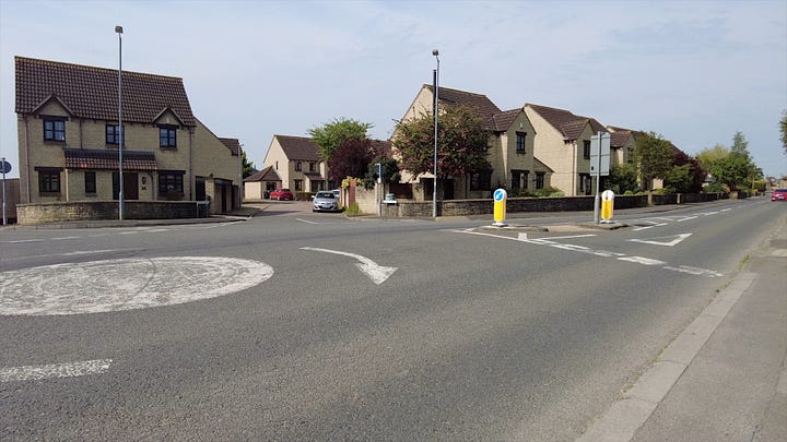
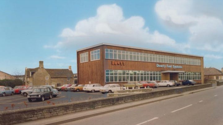
Dowty Fuel Systems and New Mendip Engineering
I soon arrive at a mini-roundabout where a housing development, Atworth Court, now covers part what was an engineering company’s land. There are some industrial units at the rear of the old Dowty site. It may have seemed strange that a company employing several hundred would be in such a small village. Dowty Fuel Systems closed in 1991, having manufactured components for the aircraft industry. The business was not always Dowty. The Dowty Group purchased New Mendip Engineering in 1948, that started operations in Atworth on this site in 1921.
The company had been formed before WW1 and made cars in Somerset at Chewton Mendip, a car manufacturer I had never heard of until researching this walk. The company's foreman was George Thatcher, who was later joined by his brother, Arthur, and together they planned and designed the Mendip Light Car. After WW1, their father joined them and the company assembled 500 cars, which sold for £355 each. Only one incomplete example remains today.
Following the owner's death, the two brothers set up a factory in Atworth. They ceased production of the car and moved on to produce high-quality engineering products and diversified into aviation parts. During WW2, the factory expanded and employed up to 600 workers. In 1948 Dowty bought the business, and it, too, had many employees. In 1969 it stood at 500.
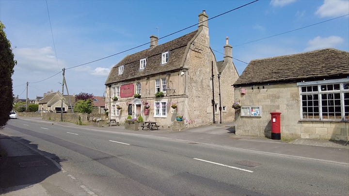
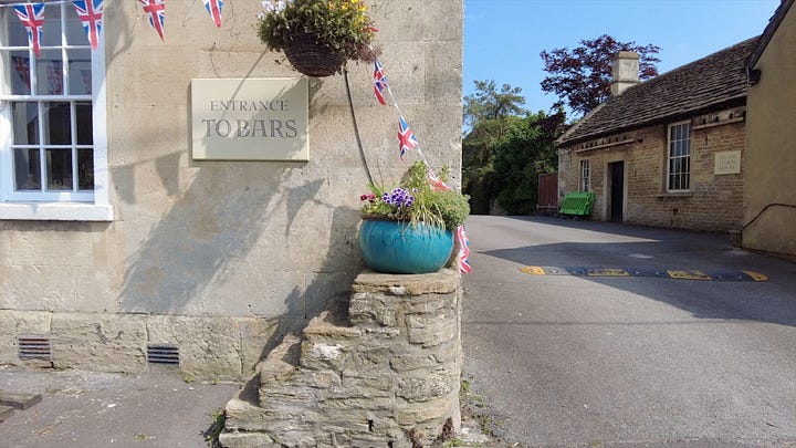
The White Hart Inn, Atworth
I next come to the only pub still open in Atworth, The White Hart. This was a coaching inn, and one of the nice features from its past which remain are the steps on one corner of the building for mounting horses. This pub has certainly been trading since before 1771 and is now Grade 2 listed to protect it from too many alterations.
Just along the road on the same side of The White Hart is a former pub, The New Inn. Its deeds go back to at least 1763. A record from 1788 showed that it was put up for sale and included the remainder of a 5,000-year lease. John Aplin, the owner, was quitting the business. It included stables, a brewhouse, a cider mill and a press. It also came with three acres of pasture and between 3,000 and 4,000 gallons of strong ale. Now that’s plenty for the locals to drink!
Besides the petrol station's convenience store, no shops remain in Atworth. The post office is now contained in the shop at this station. As you exit the village, the petrol station is the last property on Bath Road. There is one building on the corner of Post Office Lane with the look of a former shop, and it’s safe to say it was the post office.
I remember in the 1970s there was a freezer centre for which a sign pointed to Bradford Road if I remember correctly. I never went there, but my Dad did. One Saturday he went to buy a frozen chicken and ended up with a huge chest freezer. Talk about impulse buying!
A Village Pump, Atworth

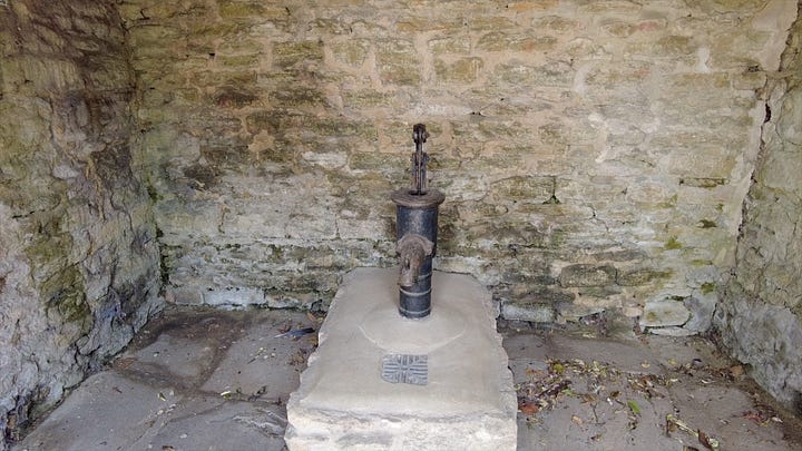
I did promise you a village pump. After passing the former New Inn, there is a stone built bus shelter, and when we look inside, there is one of the few remaining village pumps.

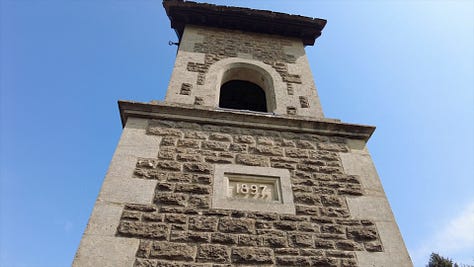


Queen Victoria’s Diamond Jubilee Clock Tower
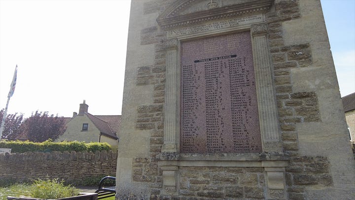
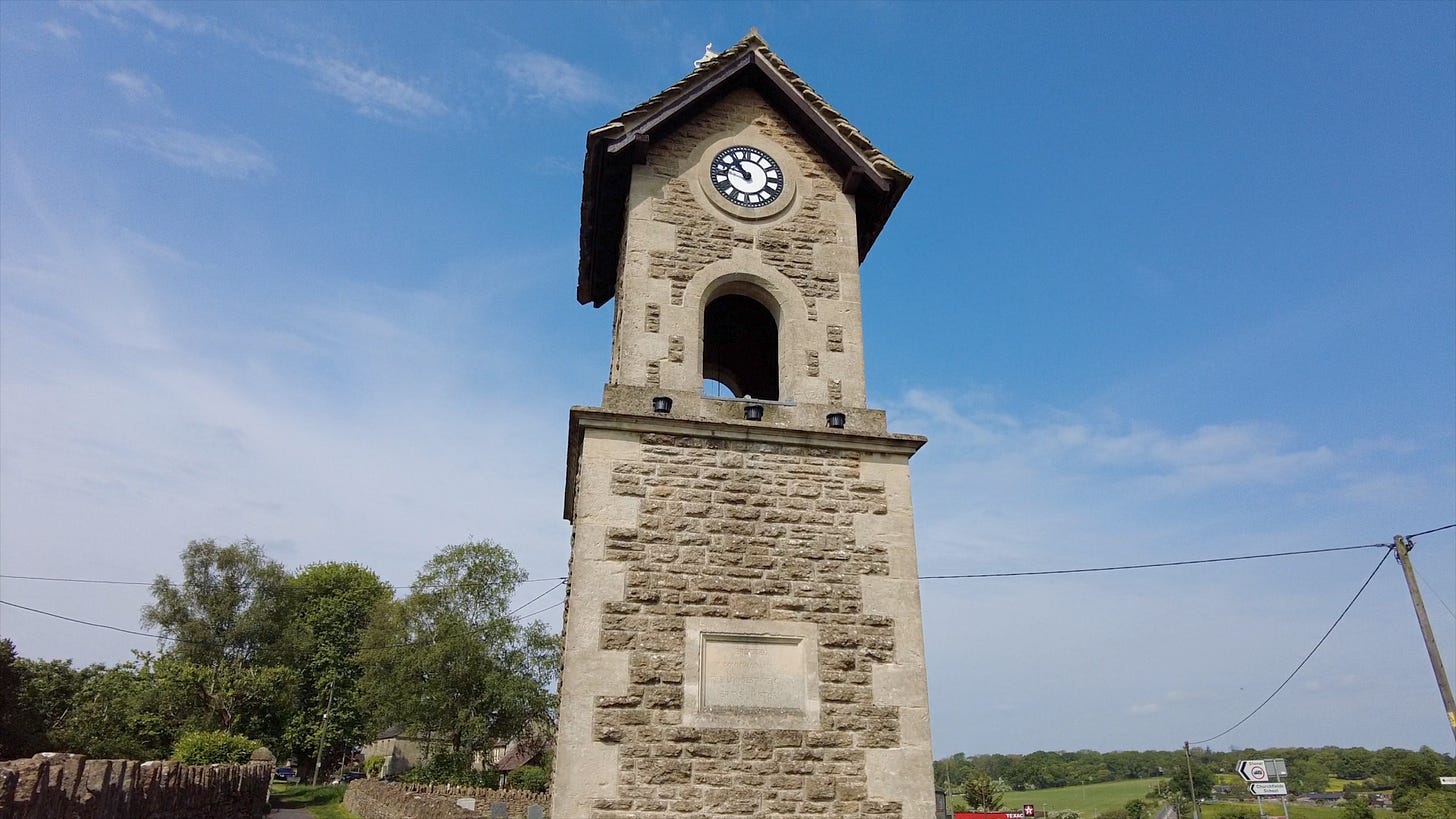
Next, we come to something any traveller passing through Atworth can’t miss. The road rises to a small hill crest, and close to the top is a magnificent clock tower. The clock tower was built to commemorate Queen Victoria’s Diamond Jubilee, 60 years reign in 1897. It was built at a cost of between £80-£100 by local subscription. It has since become the war memorial. The clock was keeping accurate time for my visit and was restored in 1999. The clock requires winding by the ‘Keeper of the Clock’.
The Independent Church
At this point in my walk, I am next to the Independent Church. The graveyard is split, with a small section beside the clock tower. The date of this building is around 1790.
I am now at the junction of Bath Road with Bradford Road, leading to my left. Before heading down there, I can see the old Turnpike Cottage, the old toll house. Standing next to it on Bath Road, and before we reach the petrol station, sits Lion Place. This is a semi-detached property which used to be a pub. In 1851 it was The Red Lion; in 1861, it was listed as The White Lion and later back to The Red Lion. By 1908 it had been converted into the two homes we see today.
Bradford Road, Atworth
Walking along Bradford Road, I can see a collection of some of the oldest properties in Atworth. Along with many cottages, there is the grand Atworth House, previously Poplar Farm House, built in the eighteenth century and added onto an older building lying behind it along with barns.
Next door is The Old Forge which has been closed for many years. It was converted by 1861 into a forge run by Richard Hampton from Potterne. In 1766 a deed involving Michael Sumsion, a publican at Colerne, referred to it as the “Three Horse Shoes” and later “Hare and Hounds”.
Opposite Old Forge is Churchfields School opened in 1828 and still serves as an infant and junior school today.

The road now splits and bends to the left, where we find the last of the cottages on that side. Facing me is what was the last pub to close in Atworth, The Foresters. This pub most likely opened in the 1800s and was finally converted into a house in 1999.
To the right of this is Church Street, my route now to see the church. Walking along this street to my left is a row of beautiful old cottages.
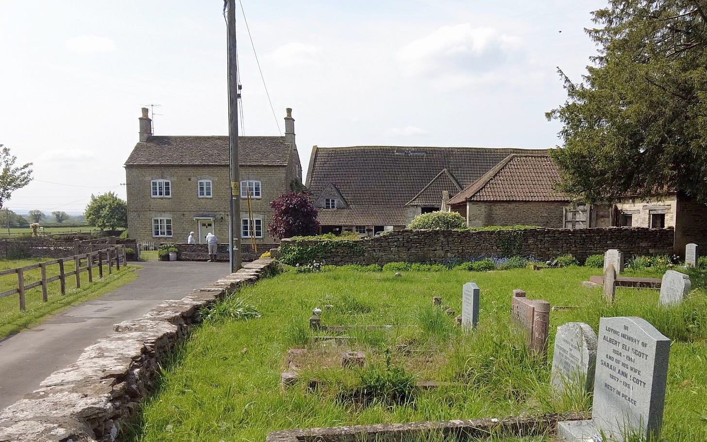
The road travels past the left of the church to Church Farm, that has a medieval barn.
Church Farm is a Bed & Breakfast, so if you’re looking for a place to stay, here is the link to the website.
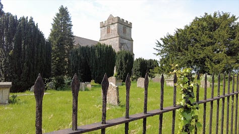
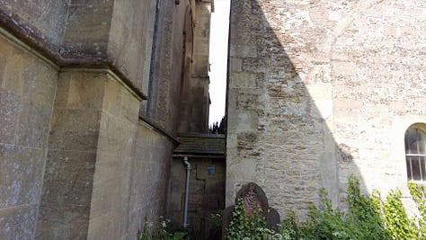
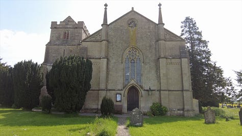
St Michael and All Angels Church was built in 1832 but note the tower. It was built in 1451; the rest of that church was demolished as it was deemed unsafe. The tower is only connected to the church by a single-storey passage, and strangely the door into the church faces away from the village. Some items, including the stone font and the four tablets, two on each side of the altar, were transferred from the old church. There has likely been a church on this site since 1001 when the Abbess of Shaftesbury was granted permission to build a chapel here.
It’s been a lovely walk through Atworth, and I hope you have enjoyed the journey with me. There are so many beautiful old houses here; undoubtedly, each one has stories to tell, many of which we will never know. That’s the fun of history!
You are welcome to leave a comment, and if you are not yet a subscriber, please ‘hit’ that button!







Nice little tour that Roland, very interesting.